Kyle Elite Concrete works as a concrete contractor in Redwood, TX on driveways, approaches, pads, slabs and repair work, and this is one of the few places in the area where we can say what is under a lot before driving out to look at it. The ground scarcely changes from one end of the place to the other.
That is unusual and it is useful. Most of the places we work are a patchwork where the soil under one street behaves nothing like the soil two streets over, and pricing has to account for the uncertainty. Here the uncertainty is small, and what it buys you is a bid that does not need padding.
Where the variation does live is in the paperwork rather than the dirt. Which road your lot fronts decides who issues the permit for your approach, and whether your slab sits inside a mapped flood zone decides whether a second permit attaches at all.
Ground That Barely Changes Across the Place
Vertisols Under 94.41 Percent of Redwood
Soil survey data clipped to the Redwood boundary and area-weighted across the named components of every intersecting map unit puts Vertisols under 94.41 percent of the place. Mollisols account for 3.60 percent, miscellaneous areas 1.38 percent and Alfisols 0.61 percent.
Vertisols are the shrink-swell clays, and a figure that high means this is a near-uniformly expansive-clay place rather than a mixed one. Twenty-four map units intersect the boundary in all, but eleven of them cover under 1 percent each and 1.89 percent between them, so the tail is genuinely a tail rather than a set of conditions a bid has to hedge against.
Houston Black Clay on 43.83 Percent by Itself
One map unit, Houston Black clay on 1 to 3 percent slopes, covers 43.83 percent of the place on its own. Heiden clay on 3 to 5 percent slopes eroded adds 13.02 percent, Tinn clay on 0 to 1 percent frequently flooded 8.27 percent, Houston Black clay on 0 to 1 percent slopes a further 7.62 percent and Houston Black gravelly clay on 3 to 5 percent slopes 7.38 percent.
Add those together and five map units account for around four fifths of the ground here. For a contractor that means the detailing question has one dominant answer rather than five competing ones, and the design effort goes into executing it properly rather than into working out which case applies.
Weathered in Place, Rather Than Carried In
The parent material tells you why the ground is so consistent. Some 57.74 percent of the named components formed in clayey residuum from calcareous mudstone of Upper Cretaceous age, with a further 20.07 percent in clayey residuum from mudstone and 8.85 percent in calcareous clayey alluvium.
Soil that weathered in place from one underlying formation is far more uniform than soil carried in and dropped by moving water, which is exactly what the coverage figures show. The alluvial fraction is concentrated along the drainages rather than scattered through the place, so where you do meet different ground, you can usually see from the lot why it is different.
Looking for concrete-contractor closer to Lockhart? See Lockhart Concrete-Contractor.
Houston Black, Measured Rather Than Assumed
Plasticity Index 44 and Linear Extensibility 12 Percent
Houston Black here is a fine smectitic thermic Udic Haplustert carrying a representative 54 percent clay, liquid limit 70, plasticity index 44 and linear extensibility 12 percent through a Bkss horizon that runs from 15 all the way to 178 centimeters. Those are high-movement numbers by measurement rather than by reputation.
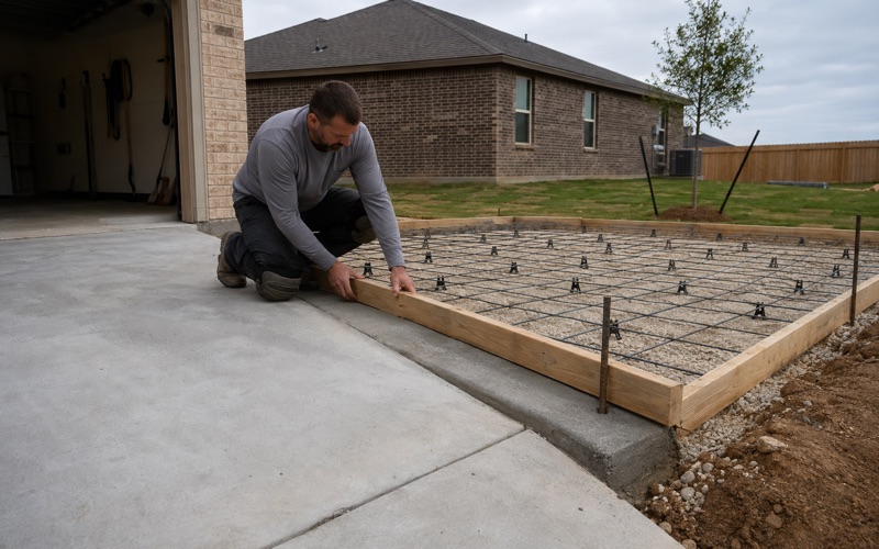
A Bkss horizon running to nearly two meters means there is no calmer layer underneath to found on and no depth at which the movement stops mattering. Reinforcing on this ground is there to keep a slab acting as one piece through seasonal movement, because nothing poured on the surface prevents the ground moving. What the steel decides is whether the slab arrives at the far side of a dry summer as one piece or as several.
Heiden and Tinn, the Other Two
Heiden carries 50 percent clay, liquid limit 60, plasticity index 40 and linear extensibility 12.1 percent, which is fractionally more movement than Houston Black despite the lower plasticity index. Tinn carries 50 percent clay, liquid limit 66, plasticity index 41 and linear extensibility 10 percent.
The three dominant soils here therefore behave within a narrow range of each other rather than presenting genuinely different design cases, which is why one well-chosen detail covers most of the place. Tinn is the exception on grounds of water rather than movement, since its main map unit is frequently flooded bottomland and that changes where concrete can reasonably be placed at all.
Subgrade That Drains at Three Hundredths of an Inch an Hour
Saturated hydraulic conductivity through both Houston Black and Heiden runs 0.21 micrometers per second, which converts to 0.030 inches per hour. In practical terms the subgrade under these map units drains essentially not at all.
That is a second design problem sitting on the same lot as the first, and it is easy to overlook because none of it is visible from the surface. Water that reaches the base under a slab here has nowhere to drain to, so it stays and cycles the clay through wet and dry states. Getting water away from the slab edge before it arrives is worth more on this ground than anything that can be done to the concrete itself.
Where Depth to Refusal Is Not the Constraint
No Restriction Recorded Across Most of the Place
Across 68.77 percent of the place the component tables record no restriction at all within the profile to 200 centimeters. That is a straightforward statement that a machine digging a footing or a trench here will keep digging.
It is worth saying plainly because it is the opposite of the situation a few miles west, and a crew used to that ground carries an excavation allowance that does not belong in a bid on this one. Pricing the hole correctly is as much a part of an honest estimate as pricing the concrete, and it is the line that most often moves once work begins.
Densic Material, Deep, Where It Exists
Where a restriction does appear it is deep and it is not stone: densic material at 147 centimeters under 15.58 percent of the place and at 122 centimeters under a further 7.78 percent, with paralithic bedrock at 137 centimeters under 2.19 percent.
Densic material is compacted rather than cemented, which means it resists digging without stopping it, and at those depths it sits well below anything a residential slab or driveway needs to reach. It becomes relevant for deep foundation work and for utility runs rather than for flatwork, so on most jobs here it is a fact about the site rather than a cost in the estimate.
What That Means for a Redwood Bid
The combination of consistent soil and unobstructed digging means excavation on a typical lot here is genuinely predictable, and excavation is the part of a concrete estimate that most often moves once the work has started. We would rather pass that predictability on to you as a firmer number than quietly build a contingency into it and keep the difference.
It also shapes what the work looks like. Manufactured housing makes up the majority of the stock here, and pads, steps, ramps and skirting aprons on a manufactured-home lot are a different product from a subdivision driveway, with their own bearing and drainage questions on ground that moves this much.
Permits Run Through the State and the County
An Approach onto FM 1978, FM 621 or FM 1979 Is a TxDOT Matter
FM 1978, FM 621 and FM 1979 all run inside the place, and SH 123 runs along its western boundary, with FM 110 lying about a quarter mile off the north edge. Every one of those is TxDOT on-system right-of-way.
A driveway approach onto any of them is permitted by TxDOT rather than by the county, so the first question on a Redwood approach job is which road the lot actually fronts. Establishing that before anything else is what keeps a schedule intact, because the two paths run through different offices with different requirements and different timelines, and discovering the wrong one late costs weeks rather than days.
County Road and Bridge, and Where County Authority Stops
Where a lot fronts a county-maintained interior road, the Guadalupe County Road and Bridge Department permits and inspects the driveway. Its subdivision regulations set a minimum private driveway width of 15 feet and a commercial minimum of 20, require the drive to extend from the paved portion of the public road to the owner’s property, and set a minimum culvert pipe of 12 inches in diameter and 20 feet in length.
The county’s own definition of a driveway marks exactly where its authority ends: an access constructed within a public right-of-way, connecting a public street with adjacent property. The portion of your drive on private ground sits outside that definition and outside the permit that attaches to the apron, which is why a single job can be half permitted work and half not, built to one continuous standard regardless.
Flood Zone Ground, and the Permit That Attaches to a Slab
Grid sampling of the place against the federal flood hazard layer puts 14.41 percent of it inside a Special Flood Hazard Area, split as 5.54 percent Zone A, 5.46 percent Zone AE and 3.41 percent AE floodway, with 85.32 percent in Zone X at minimal hazard.
That share is a permitting fact rather than a scenic one, because the county defines development to include paved storage areas, parking lots and other impervious surfaces. Flatwork is development by that definition, so a slab inside the mapped flood zone requires a Floodplain Development Permit from the county’s Floodplain Administrator while the same slab a few hundred feet away on Zone X ground does not.
- 20+ Years in Hays County
- Insured & Permitted
- Free Estimates