Kyle Elite Concrete works as a concrete contractor in Austin, TX on driveways, approaches, sidewalks, patios, slabs and repair work, and the first thing worth saying is that we will not quote this city from its name. We quote it from the address, because two jobs twenty minutes apart here can be entirely different pieces of work.
The reason is geological rather than administrative. The Balcones Escarpment runs through the middle of this city, and it separates shallow soil over limestone from deep clay that moves with the seasons. Those two conditions want different excavation, different detailing and different money.
What makes it awkward is that the seam does not follow a highway or a district boundary that anyone can point to. It runs through neighborhoods, so the useful question is never which part of town you are in but what the ground does at your particular lot.
The Escarpment Seam, and Which Side You Are On
A Sample Rather Than a Characterization
A 406-point regular grid clipped to the city polygon and queried point by point against the soil survey returns 81 distinct map units, with no dominant component above 17 percent. Those are shares of sample points across the place rather than a description of any one site. It is worth stating that way round, because a single figure quoted about this city almost always conceals more than it reveals.
By dominant component the leaders are Eckrant at 16.5 percent, Brackett at 11.6 percent, Houston Black at 10.6 percent and Urban land at 9.6 percent, with the Austin series at 6.9 percent. By soil order it runs Mollisols 42.9 percent, Vertisols 23.6 percent and Inceptisols 14.8 percent. No single one of those is the answer to what is under your slab.
West and North Against East and Southeast
The sample shows the seam plainly once the points are placed on a map. The western and northern points return shallow soils over limestone, names like Eckrant, Brackett, Speck, Eddy and Crawford. The eastern and southeastern points return deep Blackland clays instead: Houston Black, Heiden, Ferris and Burleson.
That split is the practical dividing line for anyone pouring concrete here. On one side the governing question is how far down the machine gets before it stops and how hard the material is when it does. On the other it is how much the ground will move between a wet spring and a dry August, and what the slab has to do about it.
Rock Within a Meter Under 51.5 Percent
Put a number on it and 51.5 percent of the sampled points carry a lithic or paralithic restriction within 100 centimeters. Just over half of this place is a rock-excavation problem and just under half is not. There is no version of an honest bid here that does not begin by establishing which half a lot falls in.
That figure also explains why excavation allowances vary so widely between contractors quoting the same job. One is carrying rock and the other is not, and unless somebody has actually looked, both are guessing. We would rather probe and price it than build a contingency you pay for whether or not the rock is there.
Looking for concrete-contractor closer to Geronimo? See Geronimo Concrete-Contractor.
Eight Inches to Indurated Rock on the West Side
Eckrant, the Largest Single Component
Eckrant is the largest single component in the sample and it is the hardest case for excavation. It is a Lithic Haplustoll carrying indurated limestone bedrock at a representative 20 centimeters, which is about eight inches, in its zero to two percent slope unit. Eight inches is shallower than most footings, most service trenches and a good many slab sections.
Its soil numbers read oddly against that. Eckrant carries a plasticity index of 34 and a liquid limit of 63 at 50 percent clay, but linear extensibility of only 2.8 to 5.1 percent, with 6 to 25 percent calcium carbonate through the profile. So the clay is present, the seasonal movement is modest, and the real constraint is the rock a hand’s span down.
Brackett, Rippable Where Eckrant Is Not
Brackett is the second largest component and it behaves quite differently. It is a Typic Haplustept with weakly coherent paralithic bedrock at 36 to 46 centimeters, carrying a plasticity index of 17 to 18 at 30 percent clay and linear extensibility of 2.3 to 3.3 percent, over 60 to 65 percent calcium carbonate. That is soft, rippable rock rather than indurated limestone.
The difference matters more to your invoice than almost anything else on this page. Rippable material comes out with a toothed bucket at a predictable rate, while indurated limestone needs breaking, sawing or drilling and the time involved is a different order. Two lots on the same street can sit on either one.
Where the Stone Is the Surface
The Brackett-Rock outcrop complexes that carry Brackett are 20 to 25 percent bare rock outcrop by area, with lithic bedrock recorded at zero centimeters on the outcrop component itself. On that ground the rock is not underneath the soil at all, it is what you are standing on.
There is no topsoil to strip there and nothing to compact, and a slab bearing directly on sound stone has its support question answered for it. What it does mean is that anything requiring depth, whether a footing, a trench or a service line, becomes the dominant line on the estimate rather than an afterthought.
Deep Clay on the East, and What It Costs Instead
Houston Black, Heiden and Ferris
The eastern quarter of the sample presents the opposite problem, and it is a substantial one. Houston Black in the Houston Black soils and Urban land unit carries a plasticity index of 47 to 55 with linear extensibility of 17 percent, and in the straight Houston Black clay unit a plasticity index of 44 to 45 with linear extensibility of 12 percent. Those are high-movement figures by measurement.
Heiden runs a plasticity index of 40 to 45 with linear extensibility of 10 to 12.2 percent, and Ferris 45 to 59 with linear extensibility of 7.5 to 17 percent. On this ground the digging is straightforward and the detailing is not, because reinforcement has to keep a slab acting as one piece through movement nothing poured on top can prevent.
The Austin Series, Which Sits Between
The Austin series, which the city takes its name from, sits between the two extremes and accounts for 6.9 percent of the sample. It carries a plasticity index of 28 to 35 and a liquid limit of 50 to 57 at 45 percent clay, with linear extensibility of 4.4 to 7.5 percent and 40 to 80 percent calcium carbonate, over weakly coherent paralithic bedrock at 74 to 91 centimeters.
That combination is genuinely moderate on both counts, which makes it the easiest ground in the sample to build on. Lewisville silty clay is another of the few deep, unrestricted profiles, running a plasticity index of 26 to 29 with no restrictive layer recorded to 175 centimeters.
Where the Survey Answers Nothing
On 9.6 percent of the sampled points the dominant component comes back as Urban land, which the survey maps with no plasticity index, no liquid limit, no linear extensibility and no clay percentage at all. On roughly a tenth of this place the soil data simply does not answer the question.
Where that is the case, a bore or a test pit is the only real source and anyone quoting confidently from a map is quoting from nothing. Water is the one thing that behaves consistently: hydrologic soil group D covers 83.3 percent of sampled points, so whether the cause is clay or shallow rock, water stays near the surface almost everywhere.
Why an Austin Bid Needs the Address
Permits Turn on Location, Not Size
The city puts it in its own words on the permit-exemption list: a sidewalk, driveway or concrete flatwork that is not located in the public right-of-way needs no building permit. The trigger is where the concrete is, not how much of it there is. Behind your property line a patio is unpermitted work no matter how large.
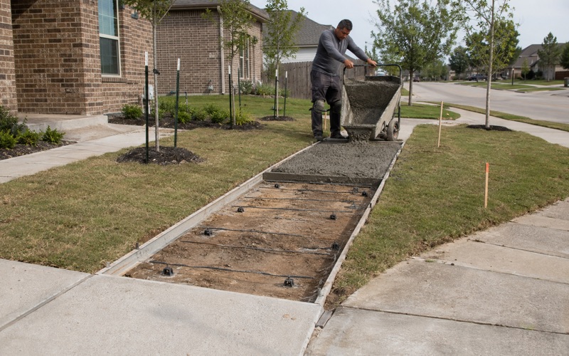
Touch the apron, the curb, the gutter or the public sidewalk and it becomes a driveway and sidewalk permit through Transportation and Public Works. The commercial exemption is narrower, with four conditions covering height above grade, what is underneath, whether it forms part of an accessible route and whether it sits in a flood hazard area.
Right of Way Work Is Licensed Work
Working in the right of way here is licensed rather than merely permitted. The license requires a bond set from the applicant’s project history and the potential damage to the right of way, expires at the end of the calendar year, cannot be transferred, and obliges the licensee to keep general supervision of the job. Subcontractors who affect the right of way must be named and licensed themselves.
The inspection regime is written into the code rather than left to custom. A Phase 1 inspection covers line and grade, forms, reinforcing steel, drainage and subgrade before the final course of material goes down, followed by a Phase 2 final inspection including cleanup. Excavation also carries fiscal security, a published street damage recovery cost and a warranty on the pavement repair.
The Approach Spec Is Written Down
A residential type 1 driveway approach in the right of way is Class A concrete: 5.0 sacks of cement per cubic yard, 3,000 psi at 28 days and 2,100 psi at 7 days, a maximum water cement ratio of 0.60, air entrained, over a two-inch minimum compacted cushion. Three-quarter-inch expansion joint material runs full depth where new work abuts existing, with weakened plane joints on 10-foot centers.
Public sidewalk is specified just as tightly, down to joint spacing and reinforcement options, with thickness treated as a pay-item choice across four, five, six and seven inches rather than a single figure. We build to those documents and name them on the proposal, so what was quoted and what gets inspected are the same thing.
- 20+ Years in Hays County
- Insured & Permitted
- Free Estimates